
powered by
- North Pacific LCC CPA |
- Maps |
- NPLCC Land Cover and Protected Areas
NPLCC Land Cover and Protected Areas
Aug 14, 2013
(Last modified Jun 2, 2015)
Created by
Tom Miewald

This item is included in Data Basin, but has not been added to the North Pacific LCC CPA.
- Description
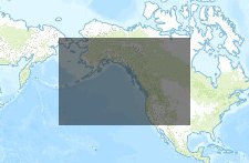
- This map represents an overview of the North Pacific LCC geography and some of the habitat and protected areas in the region. Explore the LCC and some of the data layers that the NPLCC has supported.
- Location
- Credits
- Tom Miewald
- Use Constraints
 This work is licensed under a Creative Commons Attribution 3.0 License.
This map is visible to everyone
Bookmarked by
1 Member
,
1 Group
About the Map Author
Tom Miewald
Geographer/Conservation Planner with USFWS
Tom Miewald is a Geographer with the US Fish and Wildlife Service and specializes in mapping and modeling spatial aspects of wildlife for applied conservation planning problems. Currently, Mr. Miewalds' focus is on providing decision support for the wildlife refuge system across multiple spatial...